
THE
NANDI PROGRAMME
A three-hour midday experience running from 11H00 to 14H00 or from 12H00 to
15H00.
Mittwoch 21. Dezember
|
St. Lucia, which was recently declared as a WORLD HERITAGE SITE, has some
truly unique and awesome experiences to offer YOU. If it is for the nature,
birds or just a relax you will love it here!
The adventure begin wheU board our Luxury Estuary Cruiser - environmentally
built for minimum impact on the ecology - departing from an easily
accessible jetty in the heart of St. Lucia.
The ADVANTAGE CRUISER departs in a Southerly direction first. On route,
towards the Indian Ocean where the Mouth of the Estuary meets the sea, the
tour passes a number of small Islands on which one can see numerous Nile
crocodile basking in the hot African Sun. One of the more famous bend in the
Estuary is known as Honeymoon Bend. From Honeymoon Bend large
overhanging trees and the renowned Coral Trees can be seen. On the Eastern
Shores a huge Vegetated Sand Dune stands as a memorial to the history of
this ancient land. Standing some 184 meters high, Mapelane, is the 2nd
largest Sand Dune in the World! It is one fitting that the Worlds 2nd
largest Sand Dune should rest along the banks of the Largest Estuary System
in Africa!
At this point the Cruiser turns North and heads up towards the area known as
the Narrows. On our trip towards the Narrows one passes ancient and
prehistoric vegetation in Amazon like waters. Huge Hibiscus trees drape
their garment like branches over the Estuary decorated with delicate yellow
and burgundy flowers. This is generally the area where we spot kingfisher
like: Malachite Kingfisher, Giant Kingfisher, Pied Kingfisher, Mangrove
Kingfisher, Pygmy Kingfisher and Brownhooded Kingfisher. On the highest
point of the trees and on top of the Cabbage trees one often spots the
African Fish eagle.
There are ample opportunities to take photographs as intermittent stops are
made. Tours are done at walking pace to ensure you get to see it all! A
little further up and one is introduced tot he World Famous Mangrove Swamps.
This area is teeming with life that often goes unnoticed. In these primeval
swamps creatures like Mudskippers - land living fish, Fiddler Crabs - with
huge pinchers and radiant coloring, Climbing Welts - scientific mysterious
mangrove snails, and many more smaller inhabitants make there lively hood
and scurry about all day.
The Hippo (sea cows) bellow out welcomes and show there mammoth size as YOU
witness some of the 800+ Male, Female and calves that make home in this
Largest estuary in Africa.
ADVANTAGE CRUISER has ample space for free movement throughout the tour.
Ideal for the avid photographer as the boat remains stable throughout your
adventure aboard. One of the ADVANTAGES of choosing ADVANTAGE is that she is
equipped with ablution facilities, bar and snacks. Built for comfort with a
flat bottom she is able to venture into shallow waters thus ensuring you the
closest, while considering the animals safety, possible views.
Riëtte Bennett, the only female skipper in St. Lucia, is highly qualified
and has both her SATOUR qualifications as well as a SKIPPERS marine estuary
license. Being both owner and manager of her business, you will be assured
of the best possible treatment and professional service while touring.The use of environmentally sophisticated Public Address System with actual
bird and animal sounds, Riëtte will reveal many mysteries and wonders as you
relax on the SUNDECK or sit under the shaded deck. Ideal for functions and
light meals can be provided if so required.
|
| 09H00 |
Hippo Tour -
Advantage Cruiser
(2 Hours to explore Lake St. Lucia for
hippos, crocs, fish-eagle, heron, mangroves, kingfishers, mudskippers
etc. |
R110.00 p/p
Children R55.00 |
Tel:
+27 (0)35-5901259 or
+27 (0)35-5901199
Fax:
+27 (035) 5901053
Cell (Riëtte):
083 487 2762
Cell (Danie):
082 879 4261
e-mail:
advantage@zululink.co.za |
| 12H00 |
Hippo Tour -
Advantage Cruiser
(2 Hours to explore Lake St. Lucia for
hippos, crocs, fish eagle, heron, mangroves, kingfishers, mudskippers
etc. |
R110.00 p/p |
| 16H00 |
Hippo Sunset Tour
- Advantage Cruiser (Summer)
(2 Hours to explore Lake St. Lucia for
hippos, crocs, fish eagle, heron, mangroves, kingfishers, mudskippers
etc. and to experience an exquisite sunset. |
R110.00 p/p |
zurueck Reiseroute
Freitag 23. Dezember
|
 Mittags Beach Mittags Beach
|
|
Transfers into Ballito
Zimbali Lodge is pleased to announce it will be giving complimentary trips for
individual guests, to a swimming beach in Ballito for Lodge guests.
The times are as follows:
Depart Zimbali Lodge at 10h00
Depart Zimbali Lodge 13h00
Pick-up at Beach at 13h15 back to the Lodge
Pick-up at Beach at 17h00 back to the Lodge
Guests can inform the reception desk at the Lodge on the day should they wish to
use this facility.
|
zurueck Reiseroute
Umdoni Golf Course
|
Umdoni Park Golf Course
Green fees effective from 1st February 2005
|
Monday
to
Friday |
Weekends
and Pub. Holidays |
| 18 holes - Non Members |
Visitors: Non Affiliated
** Seasonal rate (15th Dec - 15th Jan)
Visitors: Affiliated
** Seasonal rate (15th Dec - 15th Jan)
* Students/Scholar visitors
* Senior, Sages, Nomads, Etc - Mon, Tues, Thursdays
Guests playing with members
Group rates:
20-35 players
36+ players |
R165
R185
R135
R165
R65
R52
R100
R85
R80 |
R165
R185
R135
R165
R65
N/A
R100
R85
R80 |
| 18 holes - Members |
Full, Country, Associate
Senior (65+ years)
Ladies
Junior, Scholar |
R52
R45
R45
R19 |
R52
R45
R45
R19 |
| 9 holes - 50% of rates
above |

Southbroom Golfcourse Info
Southbroom Golf Club
Address: 301 Captain Smith Road, Southbroom 4277
PO Box 24, Southbroom 4277
Telephone: (03931) 60 26, Fax: 78 048
Southbroom Golf Club Winding its way through the peaceful village,
down to the sea and along a nature reserve the course at Southbroom Golf Club is
guaranteed to remain in your memory for along time. Contact: (039) 316 6051
VISITORS GREEN FEES
Financial Year 1
September 2005 to 31 August 2006
Fees quoted in South
African Rands
|
Fee by type |
18 holes |
9 holes |
| Adult |
Non
Affiliated to any club |
R 205 |
R 100 |
| Adult |
Affiliated Saturdays & Season |
160 |
85 |
| Student |
Valid
student card |
95 |
60 |
| Junior |
Scholar |
65 |
45 |
CART, CLUB & CADDY HIRE
Financial Year 1
September 2005 to 31 August 2006
Fees quoted in South
African Rands
|
Fee
by type |
18 holes |
9 holes |
| Drive
cart hire |
R 160 |
R 90 |
| Golf club
hire (includes pull cart) |
90 |
60 |
| Pull cart
hire |
15 |
15 |
| Caddy -
minimum fee |
80 |
40 |
STARTING TIMES
| |
Summer |
Autumn & Spring |
Winter |
| Morning
field |
6.30 - 8.30 |
6.45 - 8.00 |
7.00 - 7.45 |
| Afternoon
field |
11.40 - 13.30 |
11.00 - 12.36 |
10.30 - 12.15 |
| 9 holes
after field turns |
+/- 15.15 |
|
|
|
Competitions are held in
the afternoon field on Wednesdays, Saturdays & Public Holidays.
Visitors with handicaps
welcome. |
|
One
tee start on non competition days. |
Umtentweni Golf Course
GOLF COURSES Hibiscus Coast
61. Port Shepstone Country Club Established in 1915, Port Shepstone
Country Club rates as one of the most popular holiday courses in South Africa.
This well kept and easily accessible course is situated next to the mighty
Umzimkulu, one of the major rivers in KwaZulu Natal, and is quite stunning in
its natural beauty. Contact: (039) 695 0141
62. Margate Country Club The highly rated, sheer playability, 'user
friendly' course at Margate Country Club has been transformed into one of the
best facilities on the Golf Coast, attracting an increasing number of national
and international golfers. Contact: (039) 312 0571
64. San Lameer Country Club San Lameer Country Club, a majestic 18-hole
championship golf course, designed by Peter Matkovitch is rated among the top 10
courses in South Africa. Combining breathtaking beauty with an exciting and
demanding golf challenge, the designers have created a course that not only
tests playing ability, but mental ability and the will to triumph over the odds.
65. Port Edward Country Club Enjoy more than golf at the Port Edward
Country Club. This 9 hole course is short but testing with pretty coastal and
inland views. Water comes into play and the sloping fairways can be tricky to
play, but never the less it is most enjoyable.
66. The Wild Coast Sun Country Club The Wild Coast Sun Country Club
presents truly spectacular views, cutting through ravines and across waterfalls.
While the course has many memorable holes the 12th is probably the most
breathtaking hole in Africa. The Wild Coast Sun course has established itself as
one of South Africa's best and is ranked in the top 10 in South Africa by
Compleat Golfer magazine and Golf Digest. Contact: (039) 305 2799
San Lameer Golf
Course
San Lameer Country Club , a majestic 18-hole
championship golf course, designed by Peter Matkovitch is rated among the top 10
courses in South Africa. Combining breathtaking beauty with an exciting and
demanding golf challenge, the designers have created a course that not only
tests playing ability, but mental ability and the will to triumph over the odds.
San Lameer, near Southbroom, is a nature lover’s paradise. The estate is
extremely conscious of protecting the environment and a walk on the golf
course will bring one into contact with the dense coastal bush, shady
streams and rich bird-life of the region. Designed by Peter Malkovich and
Dale Hayes, thecourse was built on a flood plain and there are numerous
water hazards. It is well wooded and has lush tropical vegetation and
perfectly manicured greens.
The greens are covered in fast and smooth 'country club' green grass. The
course has provision for four different South African Courses - San Lameer
golf course tee placements; allowing it to host competitions such as the SA
Masters and at the same time providing for corporate days and amateur
players.
The 199-meter par 3 ninth hole has an elevated tee that plays to a green
that is almost completely surrounded by water. The ninth is also the
beginning of an almost continuous stretch of holes through to the 18th hole
where water comes into play. The par-three 4th could be compared with the
famous 12th at Augusta, across water to a narrow green.
Location
The golf course is situated on the Kwazulu Natal South Coast, the course is
just 3 kilometres past Southbroom heading south on the main highway between
Durban and Port Edward.Club Regulations
- Appropriate golf attire required.
- No Handicap Required Unless Entering Competition.
- Only hotel residents allowed on golf course.
|
zurueck nach Reiseroute
Dienstag 27. Dezember
Wild Coast Sun Country Club
Reserved Tee time for 2 persons
11.30 am. and one buggy.
Telephone: Telephone: +2739 305 2799
Pro Shop
Telephone: +2739 305 2799
Open daily
Hours: 07h00 - 16h00
The Pro Shop located at the Country Club specialises in all golf equipment, the
latest golf apparel and a large selection of logo golf wear and accessories are
available.
Golf Academy
Telephone: +2739 305 2799
Tuition from a PGA Professional for individual and small groups is available by
appointment.
Country Club
Telephone: +2739 305 2796
Open Daily
Snacks: 08h00 - 16h00
Bar: 10h00 - 19h00 Golfers can have their clubs conveniently stored for them at
the Club House whilst not in use and there are also locker room facilities. The
Country Club restaurant offers a great halfway house lunch and the bar has
commanding views of the golf course and offers light snacks and drinks.
zurueck nach Reiseroute
Sonntag 1 Januar
Vielleicht Ausflug nach
Champagne
Golf Resort zum Golf spielen ?????
Golf Rates:
HOTEL AND TIMESHARE RESIDENTS
ADULTS
18 holes: R 140.00
VISITORS
ADULTS 18 holes: R
260.00
CARTS
18 holes: R 150.00
SPECIAL RATES - MONDAY
& WEDNESDAY COMPETITIONS
18 holes Only = R125.00
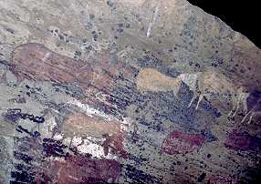
San Malereien
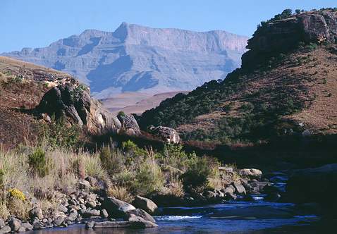
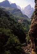
 GIANT's CASTLE
Schon im Jahr 1903 wurde der 34.000 Hektar große
Naturpark gegründet und er schützt nicht nur die einzigartige
Hochgebirgswelt um den herausragenden Gipfel namens Giant's Castle
(3.314 m.ü.M.), sondern auch die vom Aussterben bedrohten Elen-Antilopen,
die sich dort inzwischen wieder stark vermehrt haben. Diese Antilopenart
findet sich oft als Motiv in den Felszeichungen der San. Besonders in
den Sommermonaten ziehen ganze Herden umher, im Winter teilen sich die
Gruppen wieder in einzelne Tiere und Familienverbände.
Durch das Reservat führen mehrere Wanderwege
unterschiedlicher Länge und Schwierigkeitsgrade, zwischen Grasland und
Bergregenwald findet man mehrere klare und fischreiche Flüsse. Zwischen
einer Spazierwanderung von 2 km bis zu Tageswanderungen hinauf auf die
Abbruchkante ist alles möglich und ohne grosse Risiken zu bewältigen, je
nach Kondition. Den Park kann man auch zu Pferde erkunden.
Eindrucksvoll ist immer der Blick auf die ca. 35 km lange
Felswand aus Basalt, die Abbruchkante bildet die Grenze zwischen dem
afrikanischen Hoch- und Tiefland. Bergwanderer und Kletterer kommen in den
Basaltformationen voll auf ihre Kosten.
Im Reservat existiert eine vielfältige Fauna. Ausser den bereits erwähnten
Herden von Elenantilopen sind die imposantesten Vertreter eine Kolonie von
Bartgeiern. Naturfreunde aus aller Welt kommen hierher, um die gewaltigen,
schönen Tiere vom berühmten Lammergeyer Hide (Vulture Restaurant) aus
beobachten können. Hier werden die Geier seit etlichen Jahren in der
nahrungsarmen Zeit angefüttert. Ein Besuch hier muss weit im voraus gebucht
werden, da der Platz oft von Vogelkundlern und Fotoprofis komplett belegt
wird.
Von Mai bis September können sogar täglich bis zu 6
Gäste dort übernachten. Buchung: Hide Bookings, Giant's Castle, Private
Bag X7055, Estcourt, 3310. Tel (0363) 2-4616 (kein Fax).
Um 7:30 fährt für Interessierte zusätzlich ein Jeep für
150 Rand pro Person von der Rezeption zum Hide, zurück müssen die
Besucher dann laufen. |
Anfahrt und Camp
Schon der Weg nach Giant's Castle von der N 3
über Mooi River zeigt ein eindrucksvolles Bergpanorama,
abwechslungsreiche Landschaft und führt durch einheimische Dörfer der Zulu,
die sich weit verstreut in die Hügel schmiegen. Menschen und Tiere sind
häufig auf der Strasse, man sollte sich für den Ausflug auf jeden Fall einen
ganzen Tag Zeit nehmen, wenn man nicht vor Ort übernachtet.
Nach 64 km ab Mooi River erreicht man den Park.
Am Eingangstor mit Rangerposten zahlt man die Eintrittsgebühr von 20 ZAR und
dann sind es noch ca. 8 km bis zum Giant's Camp.
 Auf dem Parkplatz auf der rechten Seite können Tagesbesucher ihr Fahrzeug
abstellen und die letzten paar Meter bis zum Giant's Hutted Camp
laufen. Es besteht aus komfortablen, strohgedeckten Chalets und Bungalows,
einer Rezeption mit Curio Shop und einem Restaurant. 120 Gäste finden
hier eine Unterkunft. Der Fußweg zu den Main Caves ist von hier aus
beschildert.
Auf dem Parkplatz auf der rechten Seite können Tagesbesucher ihr Fahrzeug
abstellen und die letzten paar Meter bis zum Giant's Hutted Camp
laufen. Es besteht aus komfortablen, strohgedeckten Chalets und Bungalows,
einer Rezeption mit Curio Shop und einem Restaurant. 120 Gäste finden
hier eine Unterkunft. Der Fußweg zu den Main Caves ist von hier aus
beschildert.
Die etwas abseits davon gelegene Giant's Lodge
ist sehr luxuriös und kann für 6 Personen mit eigenem Koch gemietet werden.
Hier passierte uns eine dieser irgendwie typisch
südafrikanischen Geschichten: Im Curio Shop sahen wir ein zwar sehr
teures, aber wunderschön bemaltes Straußenei. Genau so eines mit San-Zeichnungen
ähnlich der hier gesehenen Felsbilder hatten wir schon lange gesucht. Die
freundlichen Verkäufer verpackten es sehr gut in eim Karton mit Schaumstoff,
der zugeklebt wurde. So überstand es die Reise im Kofferraum.
Am letzten Urlaubstag packten wir es dennoch aus, um es
in den Koffer zu packen und unsere Enttäuschung und Wut war sehr gross, denn
es war nicht das Ei, welches wir ausgesucht hatten. Die Grundierung des Eies
war zwar fast gleich, aber die Zeichnungen darauf waren stümperhaft
ausgeführt und wir fühlten uns richtiggehend betrogen. Ein Beweis, das man
sich nicht mal auf die Zuverlässigkeit in offiziellen Curio Shops in
Nationalparks verlassen kann. Vertrauen ist gut, Kontrolle wäre mal wieder
besser gewesen... :-(
Mit etwas Abstand tut es uns zwar immer noch leid um
das Geld, aber die Motive der Verkäufer waren vielleicht gar nicht
betrügerisch. Das Ei aus dem Laden war mit Preisauszeichnung, das Ei aus dem
Lager schon halb verpackt - warum sich zuviel Arbeit machen? Je nach
Kunstverständniss ist doch ein Ei wie das andere, zumindest steckt gleich
viel Arbeit drin. So treffen Welten aufeinander...
|
Der Weg zur Main Cave
Giant's Castle ist vor allem bekannt und gut
besucht wegen der leicht erreichbaren San Rock Art.
Im Camp beginnt der 3 km lange Rundweg und führt leicht
begehbar oberhalb vom Fluss an einem Bergrücken entlang. An besonders
schönen Aussichtsstellen stehen einige gespendete Bänke, aber eigentlich ist
der ganze Weg eine einzige schöne Aussicht. Hier Rast zu machen ist eine
Wohltat für ruhesuchende Seelen und müde Füsse.
 Allzu spät sollte man nicht loslaufen, denn der Rückweg führt unten am Fluss
entlang und kann vor allem im Winter schon früh im Schatten liegen. Uns kam
um halb zwei Mittags kurz vor dem Camp ein sehr fitter Wanderer entgegen,
der sich früh am Morgen auf den Weg "up to the escarpment", also
hinauf bis zur Abbruchkante gemacht hatte und nun nach fast 7 Stunden frohen
Mutes schon wieder fast zurück am Ausgangspunkt war. Das hätten wir
Sofakartoffeln kaum vor Sonnenuntergang geschafft, wenn überhaupt.
Allzu spät sollte man nicht loslaufen, denn der Rückweg führt unten am Fluss
entlang und kann vor allem im Winter schon früh im Schatten liegen. Uns kam
um halb zwei Mittags kurz vor dem Camp ein sehr fitter Wanderer entgegen,
der sich früh am Morgen auf den Weg "up to the escarpment", also
hinauf bis zur Abbruchkante gemacht hatte und nun nach fast 7 Stunden frohen
Mutes schon wieder fast zurück am Ausgangspunkt war. Das hätten wir
Sofakartoffeln kaum vor Sonnenuntergang geschafft, wenn überhaupt.
Schon lange vor Erreichen des Ziels kann man den
Felsüberhang sehen, unter denen sich die Malereien befinden. Mitten im Tal
zwischen zwei Flüsschen ragt der Hügel mit klotziger Felsspitze auf. Da man
dies aber nicht weiss, bevor man dort gewesen ist, achtet man naturgemäss
kaum auf diesen Felsen, sondern eher auf die mächtigen schroffen Bergriesen
im Hintergrund. Die Gipfel von Giant's Castle gehören übrigens zu den
heiligen Bergen der Zulu, auf die man nicht mit dem Finger, sondern
nur mit der Faust zeigen darf.
Kurz vor Erreichen des Eingangstores passiert man eine
Holzbrücke über einen der Bäche und muss dann noch einen etwas steileren
Anstieg bewältigen, der aber in einem schattigen Wald stattfindet, welcher
erfrischende Kühle bietet. Dann steht man plötzlich vor einem Gitter, an dem
der Guide schon wartet.
|
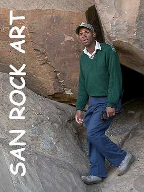 SAN ROCK ART
Die sogenannten Buschmänner aus Südafrika werden heute
endlich in ihrer eigenen Sprache als San bezeichnet. Sie hinterließen
in ihrem Lebensraum im heutigen Südafrika und in Namibia Tausende von
Felszeichnungen.
 Auch in der Region der Drakensberge fand man wahre Schätze dieser Künstler,
meist in sehr abgelegenen und schwer zugänglichen Tälern. Es gibt
Zeichnungen von Tieren und Geistern, Menschen und Händen sowie Szenen, denen
man die rituelle oder magische Bedeutung fast direkt entnehmen kann.
Auch in der Region der Drakensberge fand man wahre Schätze dieser Künstler,
meist in sehr abgelegenen und schwer zugänglichen Tälern. Es gibt
Zeichnungen von Tieren und Geistern, Menschen und Händen sowie Szenen, denen
man die rituelle oder magische Bedeutung fast direkt entnehmen kann.
Die San-Kunst ist sagenhafte 40.000 Jahre alt und die
jüngsten Zeichnungen entstanden im späten 19. Jahrhundert. Die Bilder halten
lange auf Grund der verwendeten Farben, meist wurde Rot, Gelb und Rotbraun
aus gemahlenem Ocker gemischt. Das Ganze wurde dann mit Wasser oder mit Blut
vermengt und häufig fügte man auch noch Pflanzensäfte hinzu. Die winzigen
Ockerpartikel verbinden sich mit der Steinfläche und sorgen so für eine
lange Haltbarkeit. Schwarze Farbe wurde aus Holzkohle hergestellt und Weiss
aus Lehm. Diese beiden Farben haben allerdings nicht so eine lange
Lebensdauer wie die mit Ocker.
 Besonders in den südlichen Drakensbergen sind wunderschöne, gut erhaltene
Felsmalereien zu finden. Oftmals allerdings auch auf privatem Gelände und
nicht so leicht zugänglich. Da die meisten Touristen sich nur kurz in der
Region aufhalten, werden sie am ehesten die bekanntesten Höhlen sehen, wie
die von Kamberg
oder eben die von Giant's Castle, die noch viel einfacher mit einer kurzen und leichten
Wanderung zu erreichen ist.
Besonders in den südlichen Drakensbergen sind wunderschöne, gut erhaltene
Felsmalereien zu finden. Oftmals allerdings auch auf privatem Gelände und
nicht so leicht zugänglich. Da die meisten Touristen sich nur kurz in der
Region aufhalten, werden sie am ehesten die bekanntesten Höhlen sehen, wie
die von Kamberg
oder eben die von Giant's Castle, die noch viel einfacher mit einer kurzen und leichten
Wanderung zu erreichen ist.
Auch in Lesotho gibt es zahlreiche Kunststätten
und im Gegensatz zu Südafrika ist dort alles frei zugänglich und ungeschützt.
Leider kommt es oft, meist aus Unwissenheit, zu Beschädigungen.
Die Steinmalereien dürfen niemals mit Wasser oder
irgendeiner anderen Flüssigkeit in Berührung kommen, denn Flüssigkeit zieht
Salz aus den Steinen. Die Salzkristalle dehnen sich aus und durch die
Feuchtigkeit beginnt die bemalte Fläche langsam zu bröseln. Das gilt auch
für den Handschweiss, daher ist Anfassen ebenfalls streng verboten.
San-Malereien, die Tausende und Zehntausende von Jahren
überdauert haben, wurden so schon innerhalb kurzer Zeit zerstört. Deshalb
kann man die meisten inzwischen nur in Begleitung eines Führers besichtigen,
damit sie auch weiterhin der Nachwelt erhalten beleiben.
|
Die Führungen finden hier jede volle Stunde
zwischen 9:00 Uhr und 15:00 Uhr statt und es werden nicht mehr als 20
Besucher gleichzeitig eingelassen. Vor Betreten der umzäunten Anlage wird
man nochmals mit 20 Rand pro Person zur Kasse gebeten. Wir hatten Glück und
waren die einzigen Besucher, so hatten wir eine Führung ganz für uns alleine.
 Der Führer ist eine kleine lokale Berühmtheit, ein Zulu namens
Jason aus dem Nachbardorf. Er ist bekannt für seine kleine Show, die
Besucher mit Zungenbrechern aus der Sprache der Zulu zu unterhalten,
die durch zahlreiche Schnalz- und Klicklaute für uns unaussprechlich
erscheint.
Der Führer ist eine kleine lokale Berühmtheit, ein Zulu namens
Jason aus dem Nachbardorf. Er ist bekannt für seine kleine Show, die
Besucher mit Zungenbrechern aus der Sprache der Zulu zu unterhalten,
die durch zahlreiche Schnalz- und Klicklaute für uns unaussprechlich
erscheint.
Wer sich also mal eine Art "Fischers Fritze" auf
Zulu anhören möchte, unterlegt mit Rhytmus, dem wird dies beim Rundgang
mit Sicherheit geboten. Da wir mit ihm alleine waren hat er extra für unsere
Videokamera die kleine Vorstellung noch einmal wiederholt.
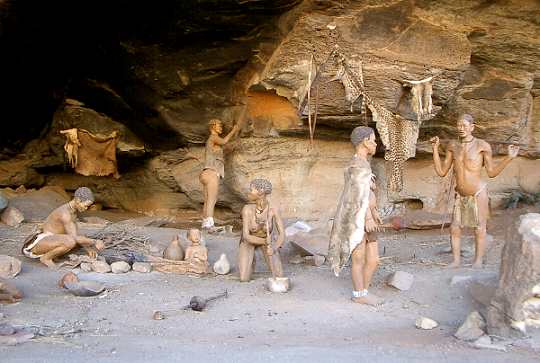
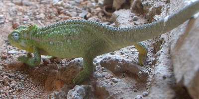
In einer Höhle ist der Alltag einer San-Familie mit
lebensgrossen Puppen nachgestellt, oben auf dem Bild zu sehen. Davor sahen
wir sogar ein kleines, grünes Chamälion. In der Mitte ist ein Beispiel für
archäologische Arbeit eingebaut: Verschieden alte Bodenschichten mit
unterschiedlich alten Relikten. Ganz unten liegen Knochen, dann kommen
Schalen, Federn, Holzkohle, Keramik, Schmuck bis hin zu Patronenhülsen ganz
oben in den jüngsten Schichten.
Auf beiden Seiten des in der Mitte zwischen zwei
Flüsschen gelegenen Felsknubbels gibt es einen Felsüberhang mit Zeichnungen.
Beide Abschnitte verfügen über Holzstege und Plattformen, damit man nahe,
aber nicht zu nahe an die Felsmalereien herankan.
|
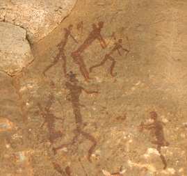
Malereien
Die Zeichnungen auf den herumliegenden Felsblöcken und
an den Wänden sind für ungeübte Augen teilweise schwer zu erkennen, auch
weil sie zum Teil winzig sind. Aber Jason zeigt mit einem kleinen Stock auch
auf das blasseste Kunstwerk und erklärt routiniert die Bedeutung - nicht
ohne humoristische Einlagen.
Gerade dadurch, daß die Bilder zum Großteil symbolisch
sind erfährt man dabei viel über die Kultur und Geschichte der San, die auch
anhand der Puppen und der dargestellten Szene erläutert wird. Neben
Jagdszenen gibt es auch Gruppen von Menschen, schwangere Frauen, Kinder und
Heiler, die Sangomas. Das wichtigste zu erbeutende Tier, das Eland,
wird gezeigt zusammen mit Menschen, die durch Handauflegen und
pantomimisches nachahmen der Gestalt die Kraft des Eland gewinnen wollen.
Menschen tanzen und Sangomas, die zuviel Drogen genommen haben,
fliegen durch die Luft.
Es ist faszinierend, wieviel Ausdruckskraft in wenigen
Strichen und Formen stecken. Nur wenige Zentimeter gross sind die
Strichmännchen und können trotzdem auch uns, die aus einer anderen Kultur
kommen, ganz genau die Stimmung und die Lebensfreude der dargestellten San
vermitteln. Diese Malereien haben die Macht der Erinnerung, sie konservieren
Ereignisse und Verhaltensweisen über Jahrhunderte und Generationen hinweg.
Die spirituelle Kraft ist kein Gerede, beim Versuch der Deutung muss jeder
Betrachter seine geistigen Trampelpfade verlassen und kommt so zu neuen
Erkenntnissen.
Am Ende des Rundgangs trägt man sich in ein Gästebuch
ein und verlässt das Gelände durch ein Tor am anderen Ende wieder. Am leise
gurgelnden, kalten und kristallklaren Fluss entlang führt der Weg zurück zum
Camp. |
Das Basotho Cultural Village - Kulturelles Pflichtprogramm als Kür
präsentiert
von Ludwig Schadhauser, Publisher Afrika aktuell
|
|
Basotho Cultural Village
Private Bag X826,
Wistieshoek, 9870
South Africa
T: ++27-58-7210300
F: ++27-58-7210304
e-mail
Website
|
Wer Lesotho und den Free State besucht, sollte sein
Pflichtprogramm an Kultur der hier siedelnden Basotho unbedingt
erledigen und dies spielerisch-leicht und jederzeit unterhaltend
im Basotho Cultural Village tun.
Es empfiehlt sich, einer geführten Tour anzuschliessen und auch
nach Herzenslust Fragen zu stellen.
Die Basotho sind im Prinzip ein Mischvolk, das im Laufe des 19.
Jahrhunderts entstand.
Entscheidend war King Moshoeshoe der Erste, gemäss der Tradition
vom führenden Stamm der Krokodile.
Allerdings: In der Region gibt es keine Panzerechsen. Daraus
folgt, dass auch die Basotho in dieses Gebiet eingewandert sind
sein grosser Verdienst war es, in den unruhigen Zeiten zwischen
1836 und 1848 versprengte Stämme in seine Nation zu integrieren
und diese von 25.000 auf 80.000 anwachsen zu lassen.
Den König wird man allerdings im Basotho Village nicht antreffen,
dagegen einen echten Chief (auch wenn es sich bei allen
Beteiligten um Schauspieler handelt), seinen Headman (obersten
Sekretär), einen geheimnisvollen Medizinmann mit all seiner Magie
sowie eben auch ganz normale Leute, gemeint sind damit vor allem
die Frauen des Chiefs, und wie sie im 16., 17. und 18. Jahrhundert
gelebt haben würden.
Beim Chief Motsueni geht es zunächst sehr formell zu. Regierung
stützt sich auf Authorität, und wer zum Chief möchte, muss erst
beim Headman vorsprechen. Wird der Bitte um Audienz zugestimmt,
erhält man die Gelegnehit, den Chief kurz zu sprechen und ein
Joala mit ihm zu trinken, ein Hirsebier nach Sotho-Art.
|
|
|
Hier lebte die Königin, in
drei verschiedenen Hütten, als Küche, Schlafbereich sowie
für Gäste
|
Nach Erledigung des offiziellen Teil folgt ein Abstecher in die
mythologische Welt der Basotho. Ein Schamane im Fell einer
(mehrerer) Ginsterkatzen, seine Hütte, geheimnisvolle Orakel,
Knochen, Zähne und Münzen, die geworfen werden, um die Zukunft zu
erkennen.
Ein paar Meter weiter hat den Besucher dann der Alltag wieder
eingeholt.
Man erfährt viel über Kochen, Wohnen und Schlafen und erkennt an
Hand der Hütten aus verschiedenen Epochen auch die Verfeinerung
des Baustils und der Inneneinrichtung.
So weist die Hütte aus dem 18. Jahrhundert bereits Fenster aus
Tierhäuten auf, es gibt richtige Haustüren die nachts mit
Scharnieren aus Leder geschlossen wurden und auch die
Inneneinrichtung der Hütten hat ein echtes Regalsystem für die
Gegenstände des täglichen Gebrauchs aufzuweisen.
Gekocht wird übrigens viel Maisbrei, Papa genannt, dazu
überwiegend Gemüse, wie etwa der als Morocho bekannte Eintopf aus
Kohl. Fleisch in grösseren Mengen gibt es eigentlich nur an
Festtagen.
Wichtiger ist es, ausreichend Vieh zu besitzen, dies zeugt von
einem gewissen Status und erhöht den sozialen Status.
|
|
|
Die Instrumente sind
modern, der Sound authentisch
|
Undenkbar wäre das Leben ohne die robusten, dabei doch relativ
zierlichen Basotho-Ponys. Sie trotzen steilem Gelände genauso wie
den hier existenten Jahreszeiten, und besitzen, wie die
Island-Ponys auch, den sogenannten 5.Gang, also eine Gangart mehr
als die normalen Pferde.
Die Führung ist, wie schon erwähnt, informativ und doch
kurzweilig.
So wundert man sich dann am Ende doch ein bisschen, wenn man nach
in etwa einer Stunde von fröhlichen Musikanten verabschiedet wird.
'Kgotso, seid gegrüsst in Frieden, und kommt wieder!'
Was übrigens an sieben Tagen in der Woche möglich ist..., Ruhetag
gibt es keinen im Basotho Cultural Village.
|
|
|
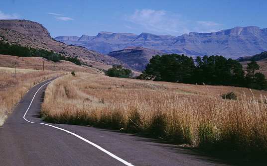
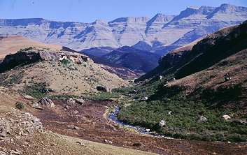
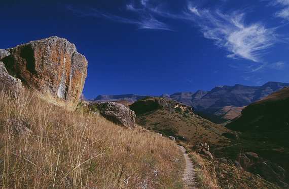
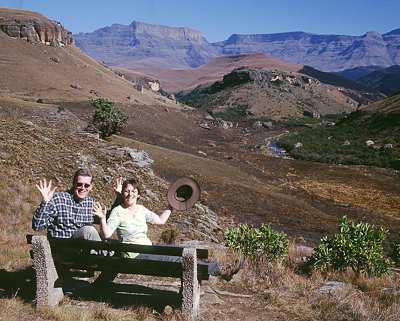
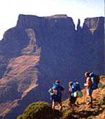
Montag 2. Januar
Royal Natal Park
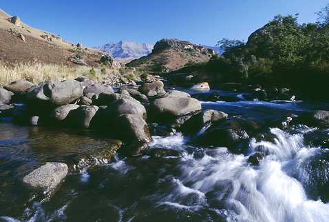
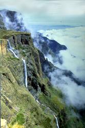
Royal Natal boasts some of the most splendid mountain scenery in Africa. The
main feature is the world famous Amphitheatre, a rock wall approximately
five km in length, and 500m high.
Above the amphitheatre is Mont-aux-Sources peak where, as its name implies,
the Orange river starts its long journey to the Atlantic ocean and Thukela
river cascades down the face of the amphitheatre, in one of the highest
waterfalls in the world, on its way to the Indian ocean. |
 |
|
 The
most popular activity at Royal Natal is undoubtedly hiking. The
most popular activity at Royal Natal is undoubtedly hiking.
A comprehensive hiking guide is available for purchase at the Visitor
Centre, at Thendele camp office and at the main entrance gate. The brochure
shows a map of the park and the network of hiking paths which visit every
part of the park from the gentle walk to Fairy Glen to the challenging hike
up the Crack and down the Mudslide.
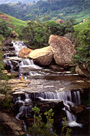
Trout fishing at Royal Natal is available in a dam in the park and in the
Mahai and Thukela rivers, and picnicking and swimming in the clear mountain
streams are popular pastimes.
The award-winning Thendele camp is situated in one of the most picturesque
settings in the country, with views of the Amphitheatre from every bungalow.
Camping is available at Mahai Campground, catering for 400 campers and
caravanners, and at Rugged Glen Campground which accommodates 45 visitors.
The stables at Rugged Glen provide opportunities to ride into the mountains
for unique views and sightings of mountain reedbuck and grey rhebuck that
seem to have no fear of people on horse back. |
WALKS AND CLIMBS
SHORT WALKS
Starting from the hotel, main campground or the picnic site:
I. Cascades and McKinlay's Pool: Take the campsite road to the casual car park.
(Only vehicles of campsite residents are allowed beyond this point).
Walk along the road past the campsite. Fifteen minutes' walk brings you to the
Queen's Causeway and the Cascades.
From there a good path leads to McKinlay's Pool at which point the Gudu stream
meets the Mahai. (Round trip 5 km : 1 hour).
 To
make a round trip, though the going is very steep, a footpath leads up towards
Dooley from the boulders near McKinlay's pool, joining the Tiger Falls/Gudu Bush
path.
To
make a round trip, though the going is very steep, a footpath leads up towards
Dooley from the boulders near McKinlay's pool, joining the Tiger Falls/Gudu Bush
path.
Return via Tiger Falls or Gudu Bush. (Whole trip 8 km : 1 hour 45 minutes).
2. Fairy Glen: Start down the
main road and cross the bridge opposite the Visitor Centre.
Then take the path to the left leading through the bush to the Broome Hill
stream.
Cross and re-cross this, then follow up through the bush to the waterfall.
This glen is well named and is a delightful picnic spot on a hot day. (1,6 km :
20 minutes).
To make a round trip from Fairy Glen: continue along the bridle path, turning
left back to the hotel at the fIrst crossroads, or left just beyond these
crossroads, along a path which leads to the main campground. (Whole trip 4 km :
45 minutes).
3. Otto's Walk: This walk
starts at the far side of the Visitor Centre car park.
It is a self-guided trail of some three kilometres and takes about 45 minutes to
complete.
A booklet providing information on the walk is obtainable from the Visitor
Centre.
Many trees are identified and the walk is signposted all the way.
4. Sunday Falls: Cross the
Mahai below the casual car park.
Follow the path up and across the intersection (signposted) and so on to the
Surprise Ridge path.
At the turning leading down to the falls is a signpost.
Cross above the falls and a track will be found leading down to the foot of the
falls. (3 km : 1 hour).
5. Bushman Paintings in
Sigubudu Valley: Take the main reserve entrance road and immediately after
crossing the second bridge, turn up along a path on the left (signposted).
Continue on, and the paintings will be found along a short stretch of
west-facing rocks. (Whole trip 6 km : 1 hour 30 minutes).
6. Forest Walk: In the Rugged
Glen area a short circular walk may be taken along a path from the visitors' car
park, up the valley, turning right along a path leading through several
attractive bush patches to the Karos Mont-Aux-Sources Hotel.
From here the route along the boundary fence, and via the road back to the
visitors' car park, is obvious. (Whole trip 4 km : 50 minutes).
7. Camel's Hump: From the
visitors' carpark at Rugged Glen (signposted), follow the path up and then
across the stream, turning left at the first junction, and so on up to the
Camel's Hump, from which magnificent views across the reserve to the Drakensberg
escarpment can be seen.
From the Karos Mont-Aux-Sources Hotel take the Main path leading into the Park,
and follow it until the Camel's
Hump is reached. (Whole trip 5
km : 1 hour 10 minutes).
LONGER WALKS
8. Tiger Falls: From Thendele Camp, Tiger Falls is an easy walk of about 30
minutes along the path below Dooley.
From the hotel area these falls can be reached from the Cascades (Walk No 1) or
through the trees behind the hotel, along a path which begins behind the hotel
stables, (between the stables and the main building).
Do not take any left turns. The falls are reached at the first large stream and
forest patch below Dooley. (3 km : 45 minutes).
Return via the Gudu Bush by continuing along the path and across the Mahai,
turning right when the bush is reached and so through the forest and down to the
hotel or main campground. (Whole trip 7 km : 1 hour 45 minutes).
9. Rugged Glen: To this area
from the hotel or main campground area, you take the reserve entrance road as
far as the park entrance.
Turn left along thc Mont-Aux-Sources Hotel road, and left again up the Rugged
Glen track to the visitors' car park (signposted). (7 km : 2 hours).>br> From
here it is possible to return to the hotel over the Camel's Hump (Walk No 7) and
Surprise Ridge, wherc you meet the path from the hotel to the Cavern.
As an alternative route, turn right and proceed to the Cannibal Caves (1,2 km)
then return to the hotel by the Surprise Ridge path. (Round trip 23 km : 7 hours
30 minutes).
From the intersection of the Rugged Glen and Surprise Ridge paths there is an
alternative route back to the hotel, via the Grotto. This adds anothcr 2,4 km to
the walk (see Walk No 16).
10. Thendele Camp: The hutted
camp established at the back of Dooley, high up on the side of the mountain,
commands a wonderful view of the Amphitheatre with the Policeman's Helmet and
Vemvaan Valley in the foreground.
There is a road to the camp but only residents may take their cars beyond the
signposted Gorge parking area.
This makes a nice morning's walk from the hotel area, travelling along the motor
road. (5 km : 1 hour 30 minutes).
Proceed back to the hotel or camping area along the path which starts on the
Thendele road below the Lodge and passes below the camp extension to the eastern
end of the natural forest and on to meet the hotel/Tiger Falls path. (Whole trip
10 kIn : 2 hours 30 minutes).
II. Gudu Falls: From Thendele
take the path past Tiger Falls to the Gudu Bush. Soon after the stream is
crossed a path to the left will be seen which leads to these magnificent falls.
From the hotel, cross the Mahai below the casual car park and proceed up the
hill to the four-way junction, turning left.
Here the path for those starting from the main campground will be met.
Continue on past the turn to the Mudslide and into the forest.
Turn right at the signpost and follow the steep path above and out of sight of
the stream for about I 600 metres, when the Gudu Falls will be reached. (4 km :
2 hours). (Whole trip 9 km : 3 hours 30 minutes).
12. Doolev Waters and the Mahai
Valley: Proceed to the upper end of the Gudu Bush (see Walks Nos 8 and 11).
Continue up the valley on the main bridle path overlooking the Mahai stream for
about 2,5 km.
Cross the Mahai stream, a very attractive picnic spot, and continue up the
north-facing slope until a path junction is reached.
Turn left up the Dooley Waters path, or alternatively right to continue further
up the Mahai valley to Basuto Gate.
{Campsite via Cascades path junction "7 km : 2 hours, 30 minutes).
NOTE: The Nek and the path from the Nek to the Basuto Gate path are closed. The
Dooley Waters path is therefore a cul-de-sac.
13. Mahai Falls and Basuto
Gate: At the Dooley Waters/Basuto Gate path junction (see Walk No 12) turn right
to continue further up the Mahai Valley to the Mahai Falls.
This is a popular picnic spot with an inspiring view down the valley.
From this point the path up to Basuto GateIWitsieshoek Mountain Resort is
obvious.
On reaching Basuto Gate/Witsieshoek Mountain Resort it is a short walk over the
ridge (the boundary of Qwa Qwa) where one gets magnificent views of the Malutis,
often snowclad in the winter months.
The word 'Mahai' is Sesuto for 'rocky krantz'. (11 km : 3 hours 45 minutes).
To make the round trip, from Basuto Gate continue along the path on the near
side of the fence for about three kilometres, crossing the source of the Gudu
Stream on the way.
Then continue to the Crack (Walk No 14) or to the top of Gudu Falls, and then
back via the Mudslide. (Whole trip 24 km : 6 hours 30 minutes).
14. The Crack and the
Mudlslide: From Gudu Bush (Walks Nos 8 and 11) continue up the valley for
another 1 200 metres where a path will be seen leading towards the Crack.
The climb is very steep but a short chain ladder helps one over the only
difficult section.
On reaching the top, bear right onto the high ground overlooking the Mahai
valley and make straight for the top of the Gudu Falls, where an easy crossing
of the Gudu stream can be made about 50 metres up.
This is a favourite place for a swim, and a good picnic spot.
Directions are hardly needed for scaling Plowman's Kop, from which point a
magnificent view is obtained.
Return down the Mudslide. This starts beyond the far corner of Plowman's Kop.
The decent is very steep and loose and, after rain, slippery .The short chain
ladder at the start is helpful.
At the foot of the cleft, follow the main path round to the right until it joins
up with the hotel path and turn left for home. (Whole trip 11 km : 4 hours 40
minutes).
NOTE: The Mudslide is not suitable for young children or those suffering from
fear of heights.
15. Surprise Ridge and Cannibal
Cave: From the hotel/main campground area head for Sunday Falls (Walk No 4) but
keep along the main path which crosses the Sunday Falls stream and later the
Sigubudu stream.
From the latter point it is only a short distance to the ridge and the park
boundary.
Just before the ridge is reached a junction with paths leading to the Grotto
(westwards) and the Camel's Hump and Rugged Glen to the east should be noted.
(10 km : 3 hours 45 minutes).
From Thendele proceed via Tiger Falls and down through Gudu Bush to the junction
of the Mudslide path and the main Mahai path, and turn left up towards the
Mudslide.
Continue past the foot of the Mudslide towards the Grotto.
Turn right to Camel's Hump/Castle Rocks.
Proceed around Castle Rocks and the Diamond until the junction referred to above
is reached, then turn left to the Ridge. (14 km : 5 hours).
From Rugged Glen proceed on past the Camel's Hump (Walk No 7) to the junction
and turn right to the Ridge. (5 km : 1 hour 45 minutes).
This Ridge is well named as there are surprisingly fine views in all directions.
On a clear day the distant peak of the Berg, including Cathkin, Champagne Castle
and Cathedral Peak can be picked out, while down below nestles the Cavern Berg
Resort and beyond this one can see the heights of Northern Natal.
To Cannibal Cave, take the track to the left along the ridge.
This path, after crossing two small streams below the Diamond on the Cavern side
of the ridge, leads to the immense cave, once reputedly a cannibal lair.
There are some Bushman paintings on the inner side of a large slab of rock in
the middle of the cave.
The walk can be extended to the ridge above the cave if time permits and it is
an easy scramble to the top from which a magnificent view is obtained (30
minutes).
One can return along the path and down to Rugged Glen (Walk No 7 or 9).
The most interesting round trip from the hotel/main campground area is to return
via the Grotto by turning right (west) at the junction below the Ridge.
Altogether the trip from the hotel area to Surprise Ridge and the Cannibal Caves
and back via the Grotto is a trip no one should miss.
The views are excellent and there are several varieties of Protea to be seen.
Mountain reedbuck frequent the area between Camel's Hump and Castle Rocks.
(Round trip 22,5 km : 6 hours 30 minutes).
16. The Grotto: The route from
Thendele is described in Walk No 15.
From Rugged Glen proceed past the Camel, Surprise Ridge (Walks Nos 7 and 15) and
on to the Grotto.
From the hotel/main campground area proceed as for Sunday Falls (Walk No 4), but
soon after passing the four-way junction and just short of the Fairy Glen
Stream, turn left up the Broome Hill valley.
Continue climbing steadily until the Grotto forest is reached.
Eventually, the path comes to a dead end, but some ten metres before this a
faint path can be seen leading upwards to the left, and a ten minute walk brings
you to the Grotto.
The Grotto is in two parts, consisting of two huge gorges cut through the
sandstone, and both are worthy of exploration. (5 km : 2 hours). (Whole trip 10
km : 3 hours 30 minutes).
17. Castle Rocks: Follow the
Grotto route (Walk No 16), but before entering the main forest, turn right to
Camel's Hump/The Diamond.
Shortly after crossing the stream turn left up towards the sandstone cliffs.
On entering the trees below the krantz turn left and follow the sandstone.
A signpost points to a hole in the krantz which takes you through the rock face;
thence up the steep grassy slope to the top.
The view overlooking the surrounding valleys is outstanding.
Although the area is well worth exploring, it is advisable to return by the same
route. (6,5 km : 2 hours 20 minutes). (Whole trip 13 km : 4 hours).
18. Broome Hill: Proceed up the
Crack (Walk No 14) to the top of Gudu Falls.
Continue up the slope, keeping the top of the sandstone cliffs on your right.
On reaching the Basuto Gate/Broome Hill path turn right.
The summit of Broome Hill can be reached in just over an hour from Gudu Falls,
and magnificent views can be obtained in all directions.
Return via the Mudslide or Basuto Gate.
19. The Cavern: Though beyond
the park boundary, this is an interesting walk.
From Surprise Ridge (Walk No 15) take the path leading straight down.
Bear left along and across a stream. A signpost directs walkers along the path ,
over another stream, then turn right and proceed down through the wattles. (Add
half an hour to the Surprise Ridge time).
20. Sigubudu Ridge: Take the
reserve entrance road to the Sigubudu Bushman paintings path (Walk No 5).
A short distance before the krantz is reached, a path strikes out to the right,
leading to the plateau above the Bushman paintings.
Walk up this plateau, finding your own way.
A path will be found which climbs up the centre of the ridge between the
Sigubudu and Forgotten valleys.
Stay on this path through the proteas until you reach a path which traverses the
head of these valleys.
Turn left to return via the upper Sigubudu Valley and Sunday Falls, or right to
reach Rugged Glen or the Camel's Hump.
This is one of the best walks to see game, especially if an early start is made.
The round trip from the hotel or the campground takes about two hours but allow
a good deal more for game spotting.
21. The Gorge: From Thendele,
proceed down to the Tugela river, where the main Gorge path will be reached.
From here the route is obvious.
From the hotel/campground area it is possible to save a three-kilometre walk by
driving to the foot of the Thendele hill, where parking will be found and the
Gorge path proper starts.
If walking, a more interesting route, enabling one to avoid the road, is to go
via Thendele camp (Walk No 10).
There is no more popular nor picturesque walk than the Gorge walk; it should not
be missed, and to enable you to make the most of the trip, take a full day over
it.
For the first 6,5 kilometres beyond the foot of Thendele hill there is a very
good path and no steep climb.
No special directions are really needed. The path winds along, above and
parallel with the Tugela river .
Not long after crossing the intersection stream from Devil's Hoek, look out for
the Policeman's Helmet on the high ground to the right overlooking Vemvaan
Valley.
The last 1 600 metres through the Gorge entails three crossings of the river
(simple enough unless in flood).
Many visitors to the Gorge turn back at the first crossing.
This is a pity, as the most picturesque scenery at Royal Natal lies at the far
end, and walking the additional 600 metres is rewarding.
Cross the stream and re-cross, keeping to the path which is on the right-hand
side of the Gorge, and keep on until you reach the chain ladder on the cliff on
the right-hand side.
The chain ladder is at the mouth of the tunnel. This tunnel is approximately 55
-65 metres long.
Use the chain ladder to skirt the tunnel or scramble through the tunnel, though
a ducking is likely, and so get into the Amphitheatre.
Boulder-hop up the Tugela for about 800 metres, where each few metres gives you
a complete change of scenery.
A steep path up the left-hand bank of the Eastern Buttress Gully leads to the
Tunnel Cave.
If you stand with your back to the chain ladder, this path will be directly in
front of you.
From the cave there is a wonderful view of the Amphitheatre wall, with the
Sentinel on your right, and you will be able to look over the Tunnel.
If you proceed around the cave you will obtain an excellent view down the valley
towards the hotel.
Warning: keep a lookout for thunderstorms, as a heavy storm may bring down the
river and delay your return trip by a few hours.
The best spot to picnic is at the end of the path, (11 km : 3 hours). (Whole
trip 22,5 km : 5 hours 30 minutes).
22. Devil's Hoek Valley: Start
as for the Gorge Walk (No 21).
Shortly after leaving the forest (10 minutes) a signpost points the way up the
valley.
Some ten minutes' walk from here, on the right, you will notice a large rock on
which there are some Bushman paintings.
Continue through a large patch of forest, uphill across an open section and into
a second area of forest.
At this point the path ends, and any further progress is hard going. (Whole trip
from the Gorge car park 6 km : 2 hours).
From Thendele camp Devil's Hoek Valley is within a thirty-minute walk.
23. Vemvaan Valley: Proceed as
for Devil's Hoek Valley (Walk No 22).
About 1 600 metres on from the Gorge car park, a path branches to the left,
crosses a stream and continues into Vemvaan Valley.
Various extensions from the head of the valley can be made by the energetic,
onto the higher ground.
An example is along the Policeman's Helmet ridge (which can be scaled from
further back).
This gives remarkable views in all directions. (Whole trip from the Gorge car
park 9 km : 3 hours).
From Thendele camp Vemvaan Valley is within an hour's walk.
24. The Lion: This walk is
outside of the park and is not sign posted.
The ridge undoubtedly affords some of the most spectacular views in the area,
and is especially good for remarkable views of the Amphitheatre, Tugela Falls
and the Sentinel.
Starting from the Gorge car park, cross the Tugela river and join the path going
around to the right of the ridge.
This path zigzags through the proteas until reaching a field ranger outpost.
Continue up the fence line until you reach the sandstone cliffs. Cross the
fence, and you will note a large cave.
To the left of the cave is a steep, grassy gully, which brings you onto the
ridge.
From here it is a steady climb upwards to the foot of the Eastern Buttress where
further progress is not recommended. (From the Gorge car park to the sandstone
cliffs: 1 hour).
25. Mont-Aux-Sources: This is
an outstanding trip, but requires at least two days, with a night being spent at
the summit of the Amphitheatre.
Numbers of visitors to the summit are restricted to 50 overnighters and 50 day
visitors.
Booking for overnight camping can be made through the Qwa-Qwa Tourist Officer ,
telephone (058) 7134415
Before setting out it is important that you complete the necessary details in
the Mountain Register which is kept at the Visitor Centre.
This formality is for your own safety.
Take the route to Basuto Gate via the Mahai Falls (Walk No 13). Note that the
Nek is closed.
At Basuto Gate/Witsieshoek Mountain Resort the motor road coming from
Witsieshoek is reached, and it is necessary to walk along the road (10
kilometres) to its end at the Sentinel car park.
From the Sentinel car park, the path zigzags uphill and takes you past the
Witches, from where a grand view of the Devil's Tooth is obtained.
Continue past the foot of the Sentinel (3 165 metres) and on to the base of
Beacon Buttress.
A steep rocky gully leads to the summit from this point, and in the old days,
this was the usual way to the top.
Nowadays it is customary, and far easier, to continue along the path to its end.
Two chain ladders (100 rungs) take you to the summit.
From the top of the ladder it is about 1 600 metres to a mountain hut, manned by
KwaZulu-Natal Nature Conservation Service field rangers on weekends and public
holidays.
If only remaining one night on the top, it is essential to be up with the sun.
There should be time after an early breakfast to walk, crossing the Bilanjil and
Ribbon Falls streams on the way, to Mount Amery (3 143 metres) overlooking the
Singati Valley.
From either of these vantage points a fine view is obtained of the distant Berg
peaks. (Whole trip: 14,5 km).
If you spend a second night at the top, there is ample time to visit the highest
point, Mont- Aux-Sources (3 282 metres) some 4 km away.
From here you can see the sources of the Tugela, Elands and the Western Khubedu
(Upper Orange) rivers.
The danger of being lost in the mist, or having to spend a night unexpectedly on
top of the mountain, must be stressed.
Keep a good lookout for changes in the weather as mists and storms come up
rapidly.
Always allow for ample time to set up camp, and avoid leaving equipment
unguarded, as there have been a number of instances of possessions being stolen.
To return:
The return journey takes no longer to go down via the Gully, climbing to the top
of Beacon Buttress (3 121 metres) on the way.
This walk should not be attempted if misty. (22,5 km : 9 hours). (Whole trip 45
km : 17 hours).
By Car:
Travelling by car, it is possible to visit the summit in a day by driving around
to the Sentinel car park at the end of the road, purchasing a permit en route.
This trip is an extremely popular day's expedition.
Again, it must be stressed that the weather at this altitude is extremely
unpredictable, and can change with alarming rapidity.
Protective clothing is therefore essential, even if you are only going for the
day.
Directions starting from the park are as follows:
Follow the main Bergville road, turning left onto the Oliviershoek
Pass/Harrismith road.
Continue over the pass and into the Free State. On reaching the Harrismith/Qwa
Qwa road, turn left. Continue on this road, turning left again at the Qwa Qwa
turnoff.
Follow this road to its end. A number of signs point the way to Witsieshoek
Mountain Resort.
Eventually a Y junction is reached, and on the left the mountain resort can be
seen.
Continue on the right-hand fork to the car park at the base of the Sentinel.
Allow two hours' walk from the Sentinel car park to the chain ladders, a number
of hours for exploring the summit, and two hours for the return journey to the
car park.
(Distance by car, one way -approximately 130 km : 2 hours 15 minutes).
VITAL INFORMATION
Gate Opening and Closing Times:
All Year Round: Opening 06h00-Closing 22h00
Office Hours At The Visitor`s Center Reception
:
The office is open from 08h00 to 16h30
Distance and Time from Gate to Camp:
3 kms to Mahai campsite and 6 kms to Thendele camp
Camp Telephone Number: (036) 4386310
Campsite Booking Number: (036) 4386303.
Bookings only between 08h00 to 12h30 in the morning and from 14h00 to 15h00 in
the afternoon.
Camp Fax: (036) 4386231
Check Out Time: 10h00
Check In Time: 14h00
Shop:
The shop is well stocked with curios and supplies.
Special Precautions:
The weather is subject to change at short notice and hikers should be well
equipped and fill in their details in the Mountain Rescue Register.
The nearest town which has a full range of
services is Bergville which is 50 kms away.
How to get there:
There are two routes from the north depending on weather conditions.
The first one is to turn off the N3 at Harrismith and take the N5 to Kestell.
2 kms down this road turn left on to the R74 to Qwa Qwa and follow the signs to
Bergville going over the Olivier`s Hoek Pass and turning right to Royal Natal
National Park at the bottom of the pass at the area tourism sign.
This route is considerably shorter than the following more conventional route
and saves an additional toll fee.
The alternative is to turn off the N3 just past Ladysmith on to the N11 and
proceed to Bergville. The reserve is well signposted from here.
From the south turn off the N3 at the Winterton/Berg Resorts off-ramp and
proceed to Bergville.
Dienstag 3. Januar
Mittwoch 4. Januar
Colesberg
Northern Cape
 The
little Karoo town of Colesberg lies half way on the route between Cape
Town and Johannesburg on the N1, picturesquely nestled in a valley
amidst the wide open Karoo landscape. The
little Karoo town of Colesberg lies half way on the route between Cape
Town and Johannesburg on the N1, picturesquely nestled in a valley
amidst the wide open Karoo landscape.
Founded in 1829, Colesberg is one of the oldest towns in South Africa.
It was named after its founder, Sir Lowry Cole, Governor of the Cape of
Good Hope province from 1828 to 1833.
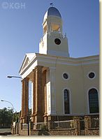
The dominant building in Colesberg is the impressive Dutch Reformed
Church in the town centre. The church dates back to the year 1866 and
interrupts the Main Street.
|
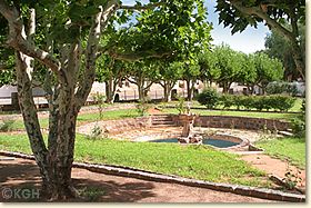
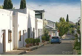
Arranged in star-shape around the
church lie some quaint, narrow streets with lovingly restored Karoo style
houses from the founding days. In this old part of town one can also find
good and affordable accommodation and good restaurants.
The history of Colesberg and its surrounding you
find documented in the Colesberg-Kemper-Museum in Murray Street.
More informations, travel advice and accommodation on our
INFO page.
Top left: Dutch Reformed
Church.
Bottom left: A
little park in the old park of town.
Top right: View of
Colesberg.
Bottom right:
Street in the old part of town. |
|
 |
 |
Donnerstag 5. Januar
Frueh morgens gleich zum Karoo
Nature Park fahren. Text aus Ingrid´s Website:
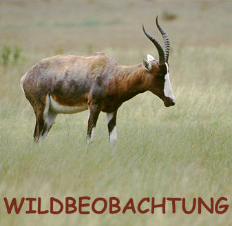 WILDBEOBACHTUNG I
Eine
besondere Attraktion ganz in der Nähe der Stadt ist die offizielle "Game
Viewing Area", auf Afrikaans heisst sie nur allzu treffend
"Wildbesitingsgebied". Nur 8 km ausserhalb des Stadtzentrums an der
Murraysburg Road gelegen und schnell erreichbar findet man hier viele
Tierarten.
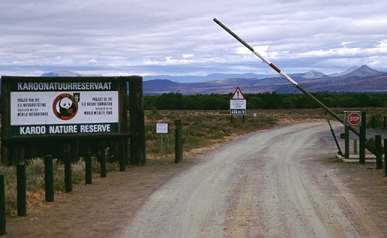
Das Gebiet ist ein Teil des Karoo Nature Reserve, das
die Stadt Graaff-Reinet hufeisenförmig umschliesst. Es grenzt an den Van
Reynevelds Pass Dam, der vom Pienaars River und vom Sundays River gespeist
wird. So finden die zahlreichen Tiere ständig Wasser.
Eine Fahrt durch das Gebiet kostet keinen Eintritt,
alles ist frei zugänglich. Es existiert nur eine Zufahrt mit Schlagbaum,
der nach Einbruch der Dunkelheit geschlossen wird. Am Eingang gibt es ein
kleines Informationszentrum mit Schautafeln und Toiletten.
Besonders in den frühen Morgenstunden und am späten Nachmittag lohnt sich
ein Besuch in dem Gebiet. Dann lassen sich die Tiere besonders gut
beobachten und die ganze Landschaft ist in ein herrliches Licht getaucht.
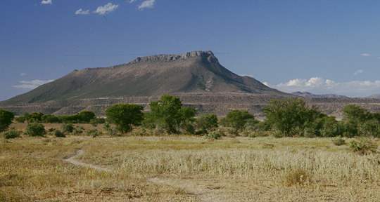
Die Ebene wird am Horizont begrenzt durch die umliegenden Berge.
|
 Regeln Regeln
Die Besucherzahl innerhalb des Geländes hält sich in Grenzen, man begegnet
zwar einigen Autos, aber gelegentliche Staus in der Nähe von Tieren wie in
anderen Parks findet man hier nicht. Obwohl man sich innerhalb des Gebiets
frei bewegen kann, sollte man einige Regeln beachten.
Absolut verboten ist das Fahren ausserhalb der gut
ausgebauten Wege. Man kann hier zwar aus dem Wagen kurz austeigen, weil es
ausser Büffeln und Gnus wenig gefährliche Tiere gibt, sollte aber stets in
der Nähe des Autos bleiben und tut dies auch auf eigenes Risiko.
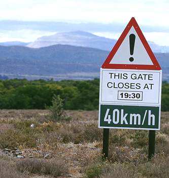
Das Speed Limit innerhalb des Gebiets ist auf
den Schildern mit 40 km/h angegeben, auf der Webseite von Graaff-Reinet
mit 30 km/h. Schneller will man aber auch gar nicht fahren, weil man sonst
ja leicht die zum Teil sehr gut getarnten Tiere übersieht - so ist man
zumeist im Schritttempo unterwegs. Anhalten kann man überall.
Feuer ist nur am Impunzi Picknickplatz erlaubt, hier
gibt es auch Toiletten. Das man keine Tiere stört oder Pflanzen ausrupft
versteht sich ja wohl von selbst. Auch seinen Abfall soll man
selbstverständlich im Auto lassen und wieder mit aus dem Park nehmen.
Am Schlagbaum liegt eine Liste aus, wo man sich beim
Hinein- und Hinausfahren mit Wagenfarbe und Kennzeichen ein- und wieder
austrägt. So kann der Ranger eine Suche einleiten, wenn jemand
vermisst wird oder im Park einen Unfall hatte. |
| Die Bilder dieser
Seite und der folgenden zum gleichen Thema sind alle im
"Wildbesichtigungsgebiet" entstanden, meist am späten Nachmittag. Wir
haben einige Stunden auf dem Gelände verbracht und wurden nie müde, die
zahlreichen Tiere zu beobachten. |
 WILDBEOBACHTUNG II
Innerhalb
der 14.000 ha grossen Game Viewing Area des Karoo Nature Reserve, gibt
es einige gut befahrbare Rundwege.
Hier ist es wirklich herrlich und das Gebiet ist ein
richtiger Geheimtipp. Besucher sehen hier manchmal mehr Wild in zwei
Stunden, als in grösseren Gebieten an einem Tag. Auch wir hatten viel Glück,
wie die Bilder der beiden Seiten zeigen. Besonders toll ist die lange
Öffnungszeit, andere Parks schliessen oft schon um 18 Uhr, um ihre
Sunset-Drives verkaufen zu können. Und gerade dann sieht man die meisten
Tiere.
Nach dem Gate überquert man zuerst den Pienaars River
und fährt dann ein Stück durch lichten Wald, in dem man meist schon den
ersten Tieren begegnet. Hier sind es oft die kleinen Duiker und grosse
Gruppen von Perlhühnern, die man leicht im Gras übersieht.
Dann führt eine Schleife nach rechts in Richtung des
Stausees. Hier sollte man vor allem am späten Abend hinfahren, denn das
Gebiet ist mit dichtem, hohen Gras bewachsen. Das zieht vor allem die
kleinen Springböcke und andere Arten von Antilopen an, die dann hier liegen.
Nur die Köpfe gucken aus dem Gras.
Ganze Herden liegen und äsen am Wegrand und lassen sich
durch gelegentlich vorbeikommende Autos berhaupt nicht abschrecken.
 Am Ende der
Schleife zum See trifft man wieder auf den Hauptweg, der eine zweite,
grössere Schleife über die weiten Ebenen des trockeren Parkteils bildet.
Eine Abzweigung führt zur Impunzi Picnic Site, hier kann man Rast machen und
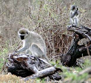
es gibt Toiletten. Ganz in der Nähe haben wir die meisten Affen beobachten
können: grüne Meerkatzen mit Jungtieren. Am Ende der
Schleife zum See trifft man wieder auf den Hauptweg, der eine zweite,
grössere Schleife über die weiten Ebenen des trockeren Parkteils bildet.
Eine Abzweigung führt zur Impunzi Picnic Site, hier kann man Rast machen und
es gibt Toiletten. Ganz in der Nähe haben wir die meisten Affen beobachten
können: grüne Meerkatzen mit Jungtieren.
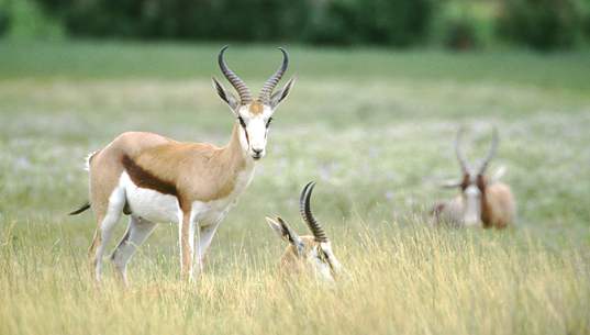
In den wellligen Ebenen sieht man oft Gnus und Büffel
in kleinen Herden oder auch einige Einzelgänger. Strausse und grössere
Antilopen lassen sich hier auch gut beobachten.
Am Ende trifft der Rundweg dann wieder auf eine
T-Kreuzung, an der ein mit Pumpe betriebenes Wasserloch liegt. Mit etwas
geduligem Warten kann man hier viele Tiere beobachten, vor allem Vögel, die
zum Trinken ans Wasser kommen. |
Flora und Fauna
Zahlreich sind die Tierarten, die sich hier im Karoo Nature Reserve
beobachten lassen. Natürlich hat man keine Garantie, dass man auch alle
sieht. Aber wir sind hier nach jedem Besuch hochzufrieden wieder weggefahren
und haben immer wieder neue Arten entdeckt.
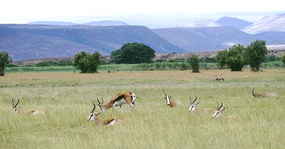
43 verschiedene Säugetierarten leben hier. Vor
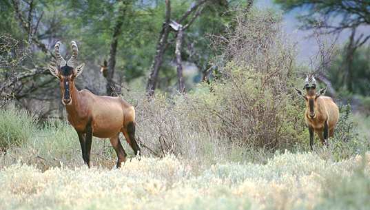
allem die Antilopen sind zahlreich vertreten und lassen sich sehr gut
beobachten. Die hübschen Kudus mit den grossen Hörnern, Kuhantilopen,
Springböcke, Steinböcke und die kleinen Duiker findet man hier.
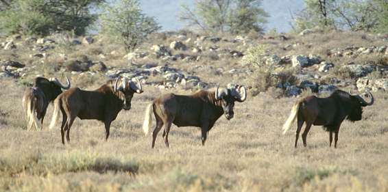
Dazu kommen noch Gnus, Büffel, Schakale, Mungos, Grüne
Meerkatzen, verschiedene Mäuse, Flughunde, Klippspringer, Ratten, Wiesel und
zahlreiche Schlangen und Insektenarten. Andere Gäste bei Beatrice haben an
einem Morgen auch eine kleine Raubkatze gesehen, vermutlich einen Luchs.
Auch die Vogelwelt ist reichhaltig vertreten und wurde
sogar gezählt. |
Sonntag 8. Januar bis
Freitag 13. Januar
Hier unten stehen einige Ideen
um die Zeit zu "vertreiben" !
Hotel Santé at the Winelands
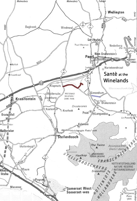
DIRECTIONS TO SANTÈ WINELANDS
Santé Winelands is situated between Paarl and
Franschoek in the Simondium region.
From Stellenbosch:
- Take the R44 in the direction of Paarl.
- Before the Klapmuts intersection turn right
on road leading to Backsburg & Glen Carlou estates. Distance - from the R44 /
Bird street intersection approx 14.7 km to Backsburg / Glen Carlou turn-off.
- Look out for Glen Carlou estate on right.
Distance - 3.2 km from turn-off to Glen Carlou entrance gate.
- Turn left at next road. This is sign posted
as Simonsvlei Road and lies just over the next rise. Distance - from the Glen
Carlou entrance gate to the turn-off approx 0.8 km
- Follow gravel road until you reach the Santé
Winelands entrance gate on the right. Proceed to security who will make
contact with the marketing staff. Distance - from the start of gravel road to
gatehouse approx 2.4 km.
Tel: +27 (0) 21 875 8100
Fax: +27 (0) 21 875 8111
Email: info@santewellness.co.za
Postal Address: PO Box 381, Klapmuts, 7625 South Africa
Physical Address: Simonsvlei Road, Road 45, Paarl-Franschhoek Valley
François en Nia besuchen in Houtbay und zum World
of Birds gehen.
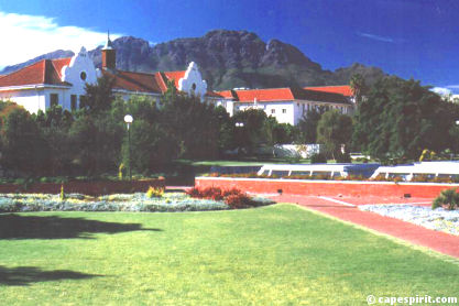
Stellenbosch
Stellenbosch, beautifully situated
in the heart of the Cape Winelands, is the second oldest town in South
Africa. A walk through Dorp Street and a visit to Oom Samie se winkel
(Ungle Samie’s shop) introduce you to the fascinating history of this
University town. The historical University grounds is an attraction in
itself. Jonkershoek Valley provides stunning mountain scenery and is a
must- visit for all nature lovers. Further on, between Stellenbosch
and Strand you will find the popular Mooiberg Farm Stall. Here you can
buy jams and food you’ve only dreamed about…
 A
visit to historical Stellenbosch should be on any traveller’s wish
list. The town, known as the “City of Oaks” is famous
for its beautiful streets lined with Oaks and white painted buildings,
of which many date back as far as the 1700s. Many students will agree
that the town is like no other on earth – actually a world on its own.
The best way to explore this gem is on foot (the student way), and it
is relatively small enough to discover within a day or so.
Guided walks are also popular – contact Cape Spirit Travel for more
details.
A
visit to historical Stellenbosch should be on any traveller’s wish
list. The town, known as the “City of Oaks” is famous
for its beautiful streets lined with Oaks and white painted buildings,
of which many date back as far as the 1700s. Many students will agree
that the town is like no other on earth – actually a world on its own.
The best way to explore this gem is on foot (the student way), and it
is relatively small enough to discover within a day or so.
Guided walks are also popular – contact Cape Spirit Travel for more
details.
The Cape Spirit
Stellenbosch Town Walk
Start your walk at the
Stellenbosch Tourism Information Bureau located at “Die
Braak” (a small town park) on Market Street, where you can obtain a
street map of the town. You can also decide here if you would like to
add any other attractions to our suggested walk.
Close to Die Braak, on the corner of
Alexander and Bird Street, you will see the Dros Restaurant
and Wine Cellars. This is one of the most famous and longest
established student and local hangouts. It’s the perfect spot to meet
some of the locals and get a feel for the town.
From Die Braak head down in Market
Street towards Dorp Street (Afrikaans term for “Town
Street”). Dorp Street should be the focus point of any tourist’s visit
to Stellenbosch. It is here where you will find the most listed
historical houses in South Africa. Walk to the corner of Dorp
and Old Strand Road where you will see the Libertas Parva building, an
immaculate restored homestead. Built in 1783 it houses the famous
Rembrant van Rijn Art Gallery and the Oude Meester Wine Museum today.
The Oude Meester Wine Museum documents the history of winemaking in
South Africa, and is worth the visit.
 Continue
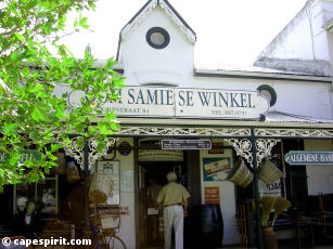
east up in Dorp Street towards the ever-so-popular Oom Samie
se Winkel (Ungle Samie’s Shop) – the oldest shop in
Stellenbosch. The shop has been trading since 1904 and well, not much
has changed since. You will find everything of anything here - from
hats to cups to antiques to food – most items date back many years.
It’s the perfect place to grab something interesting and unique for
the loved ones home.
Continue
east up in Dorp Street towards the ever-so-popular Oom Samie
se Winkel (Ungle Samie’s Shop) – the oldest shop in
Stellenbosch. The shop has been trading since 1904 and well, not much
has changed since. You will find everything of anything here - from
hats to cups to antiques to food – most items date back many years.
It’s the perfect place to grab something interesting and unique for
the loved ones home.
Walk all along Dorp Street - much of
the town’s original village feel can still be experienced here and it
is like walking through a different time period. You will pass some
interesting buildings along the way - including the Lutheran Church
(corner of Dorp and Bird Street), La Gratitude (95 Dorp Street),
Saxenhof (159 Dorp Street) and the Theological Seminary (171 Dorp
Street). Continue until you reach Drostdy road, and turn left. You
will see the fascinating Moeder Kerk on your right – this is the
town’s main Dutch Reformed Church and one of the most
spectacular buildings in Stellenbosch. Turn left again into Church
street for a lunch break at the historical D’Ouwe Werf – South
Africa’s oldest country Inn, established in 1710. Alternatively you
can visit Die Wijnhuis (Wine house), on the corner of Church and
Andringa Street. It is a great place for wine tasting and lunches with
hundreds of the region’s wines displayed under one roof.
Turn into Van Ryneveld Street in a
northern direction. Stop at The Village Museum (18
Van Ryneveld Street) for a beautiful insight into the town and its
rich history. The museum, set in the oldest part of Stellenbosch, is
divided into four historical houses and gardens, each reflecting a
different architectural period with some beautiful Cape Dutch
architecture. Across the road and further on you will find the
Stellenbosch Art Gallery (corner of Van Riebeeck and
Van Ryneveld) and the Sasol Art Museum (34 Van
Ryneveld Street) Both buildings hold some impressive collections of
art. Even those not interested in art will find a visit rewarding: It
provides a good insight into the town and cultural aspects of the
country and its people.
Continue along Van Ryneveld until you
reach Victoria Street. Accross this corner you will
see an impressive white building called the Ou Hoofgebou
(Old Main building). This is the oldest academic building of the
University of Stellenbosch and was inaugurated in 1886. Today it
serves as a national monument and houses the University’s Law Faculty.
Turn right into Victoria street and walk all along this beautiful
street lined with Oak trees. You are now in the main University area
and many faculty buildings and student hostels are located on this
road. You can continue to the very end of this road (a long but
relaxing walk) and go into Jan Marais nature park for a quick stroll
(look out for the proteas).
Your last attraction on our walk is
the famous University Rooiplein (“Red Square”),
located between Victoria, De Beer, Merriman and Van Ryneveld Streets.
This is the very centre of the University of Stellenbosch and is
surrounded by beautiful architecture and spectacular mountains. It’s
like being in Oxford but only in Africa. Grab a quick bite with the
students at the Langenhoven Student Centre or visit the biggest
underground library in the Southern Hemisphere, both situated around
the Rooiplein.
 Other
Stellenbosch Attractions
Other
Stellenbosch Attractions
Apart from the Cape Spirit
Stellenbosch Town Walk, do not miss these exciting destinations – all
located within easy reach of Stellenbosch:
Jonkershoek Nature Reserve
The small road circling through the Jonkershoek Mountains is
spectacular. The reserve is famous for its mountain trails (bicycles
are also welcome) and there are five hiking routes ranging from easy
5km ones to more challenging routes. Don’t miss the walk to the second
waterfall, Cape Spirit Travel’s favourite walk. The first part of the
walk is easy and can be accompanied by the whole family. The route
takes you through breathtaking scenery, including beautiful fynbos and
is sadly not experienced by many visitors to Cape Town. Take note that
the last section of the trail is dangerous and has been closed to the
public. Jonkershoek should not be missed by anyone and it can easily
be a whole day’s outing. For those not keen on hiking it is still
worth driving through the reserve to experience the dramatic nature
scenes.
 Spier
Wine Estate The Mother of Stellenbosch wine estates has
become more popular than ever. The whole estate is a tourist complex
with plenty to do – activities include horse riding, wine tasting,
interaction with cheetahs and a beautiful picnic area. Outdoor
festivals are also held at Spier during summer months. The estate is
part of the oldest wine route in South Africa with more than 100 wine
farm members. Don’t forget to ask for more details on other great wine
farms when you book through Cape Spirit.
Spier
Wine Estate The Mother of Stellenbosch wine estates has
become more popular than ever. The whole estate is a tourist complex
with plenty to do – activities include horse riding, wine tasting,
interaction with cheetahs and a beautiful picnic area. Outdoor
festivals are also held at Spier during summer months. The estate is
part of the oldest wine route in South Africa with more than 100 wine
farm members. Don’t forget to ask for more details on other great wine
farms when you book through Cape Spirit.
Van Ryn Brandy Cellar
The Van Ryn Wine and Brandy company dates back to 1845, and has a
proud tradition of brandy excellence. Daily tours (expect Sundays)
will take you through this historic distillery celebrating South
Africa’s brandy industry. You will visit the cellar, see the resident
cooper practise his ancient craft, and learn more about the art of
brandy maturation.
Festivals and summer concerts
The Oude Libertas Amphitheatre, know as the “theatre in the winelands”
presents some of the smartest of local and international performances
during their annual summer theatre festivals. (December – March each
year) It is the perfect spot to relax with a supper picnic bag.
Everyone’s invited!
Mooiberg Farm Stall
The stall is packed with a great selection of interesting homemades
and farm products. Grab something you’ve never tasted before. It is
located halfway between Stellenbosch and Strand on the R44 Strand
Road. From Spier you can take Annandale Road off the R310 that will
take you towards the R44.
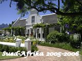
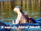

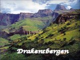
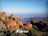
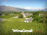
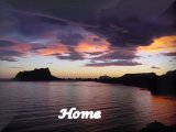
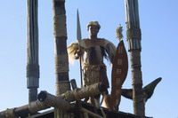
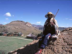
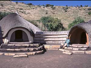
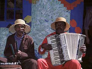
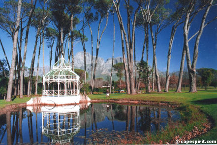
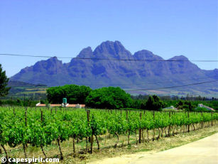 Franschhoek
has become known as South Africa’s food and wine capital and many
of South Africa’s top chefs live here. Not surprisingly, the town
is home to 8 of South Africa’s top 100 restaurants. And it is not
only wine and dine – a visit to the Huguenot Fine
Chocolates on 62 Huguenot Road is a sweet experience.
This shop produces over 6000 chocolates a day, and you will find
their chocolates in many Franschhoek guest houses and wine
estates. Try their delicious Amarula chocolates for a true African
Belgium taste.
Franschhoek
has become known as South Africa’s food and wine capital and many
of South Africa’s top chefs live here. Not surprisingly, the town
is home to 8 of South Africa’s top 100 restaurants. And it is not
only wine and dine – a visit to the Huguenot Fine
Chocolates on 62 Huguenot Road is a sweet experience.
This shop produces over 6000 chocolates a day, and you will find
their chocolates in many Franschhoek guest houses and wine
estates. Try their delicious Amarula chocolates for a true African
Belgium taste. 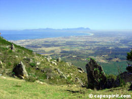 Continue
onto the N2 highway and turn right towards Somerset West / Cape
Town. You will soon start climbing up the breathtaking Sir
Lowrys Mountain pass, where you can stop at the lookout
point on your left just before circling down. The lookout provides
fantastic views across False Bay (left), Somerset West and Table
Mountain (centre), and the Helderberg Mountains (right). You might
just find that you share the view with a group of famous baboons
always entertaining the crowd.
Continue
onto the N2 highway and turn right towards Somerset West / Cape
Town. You will soon start climbing up the breathtaking Sir
Lowrys Mountain pass, where you can stop at the lookout
point on your left just before circling down. The lookout provides
fantastic views across False Bay (left), Somerset West and Table
Mountain (centre), and the Helderberg Mountains (right). You might
just find that you share the view with a group of famous baboons
always entertaining the crowd. 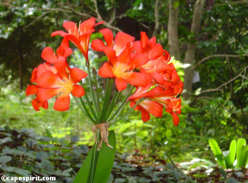 Kirstenbosch
is one of the seven magnificent botanical gardens in the world
and you simply cannot miss a visit.
Kirstenbosch
is one of the seven magnificent botanical gardens in the world
and you simply cannot miss a visit. 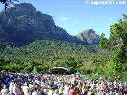 Do
not miss the beautiful walk up to the summit of Table Mountain
through Skeleton Gorge. If your time is
limited or you don’t feel like climbing to the very top, walk
up for about 15 minutes for some nice views over the southern
suburbs.
Do
not miss the beautiful walk up to the summit of Table Mountain
through Skeleton Gorge. If your time is
limited or you don’t feel like climbing to the very top, walk
up for about 15 minutes for some nice views over the southern
suburbs. 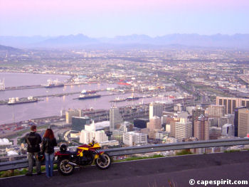 Get
your camera and map, and grab your hiking shoes.. Africa’s
southernmost city is calling!
Get
your camera and map, and grab your hiking shoes.. Africa’s
southernmost city is calling! Adderley
Street was once the main shopping street in Cape
Town but much of the city’s focus moved to the V&A
Waterfront during the last view years. One can probably
still call this Cape Town’s main street and developers are
currently restoring the street back to its former glory
days and bringing back the high street shops. Turn right
into Adderley and walk all the way up with Table Mountain
in front of you. Observe the great diversity of South
African society rushing to work. (Although the pace is not
nearly as fast as in other world cities – and don’t be
surprised if people start rushing back just before four..)
Adderley
Street was once the main shopping street in Cape
Town but much of the city’s focus moved to the V&A
Waterfront during the last view years. One can probably
still call this Cape Town’s main street and developers are
currently restoring the street back to its former glory
days and bringing back the high street shops. Turn right
into Adderley and walk all the way up with Table Mountain
in front of you. Observe the great diversity of South
African society rushing to work. (Although the pace is not
nearly as fast as in other world cities – and don’t be
surprised if people start rushing back just before four..) The
Company Gardens An interesting city park
founded by Jan Van Riebeeck in 1652. It was originally
built to serve as vegetable supply for passing ships. More
than 8000 plant species can be found here and there is a
coffee shop and restaurant between lovely trees.
The
Company Gardens An interesting city park
founded by Jan Van Riebeeck in 1652. It was originally
built to serve as vegetable supply for passing ships. More
than 8000 plant species can be found here and there is a
coffee shop and restaurant between lovely trees. Time
to visit Greenmarket Square – a popular
and must see African market located between St Georges
Mall and Burg Street. The market dates back to 1696 when
locals gathered here to trade and socialise. It operates
Monday to Saturday from early morning until about 4 pm.
Visit the Michaelis Art Collection located in Old Town
House on Greenmarket Square. The building holds a world
renowned Dutch Art Collection dating back to the Golden
Age.
Time
to visit Greenmarket Square – a popular
and must see African market located between St Georges
Mall and Burg Street. The market dates back to 1696 when
locals gathered here to trade and socialise. It operates
Monday to Saturday from early morning until about 4 pm.
Visit the Michaelis Art Collection located in Old Town
House on Greenmarket Square. The building holds a world
renowned Dutch Art Collection dating back to the Golden
Age.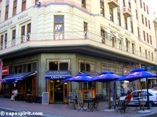 A
journey on the Cape Town Explorer provides a unique
opportunity to view the city from the roof of a joyful
bus. Hop on and off at any of its stops, which include the
V&A Waterfront and Cape Town International Convention
Centre. (corner of Coen Steytler Ave and Buitengracht
street) Tickets can be purchased on the bus and are valid
for a full day. It stops at major tourists
attractions along its circle journey, of which the
following city attractions should not be missed: District
6 Museum, the Cape Castle, the Gold Museum and Jewel
Africa.
A
journey on the Cape Town Explorer provides a unique
opportunity to view the city from the roof of a joyful
bus. Hop on and off at any of its stops, which include the
V&A Waterfront and Cape Town International Convention
Centre. (corner of Coen Steytler Ave and Buitengracht
street) Tickets can be purchased on the bus and are valid
for a full day. It stops at major tourists
attractions along its circle journey, of which the
following city attractions should not be missed: District
6 Museum, the Cape Castle, the Gold Museum and Jewel
Africa.  The
island is one of the most famous in the world – this is
where ex-president Nelson Mandela spent
18 years of his imprisonment during his struggle against
apartheid.
The
island is one of the most famous in the world – this is
where ex-president Nelson Mandela spent
18 years of his imprisonment during his struggle against
apartheid.